Cedar Island and Beavertail Ridge, Deschutes River - c. 1909
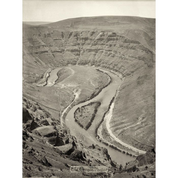
This overview of Beavertail Ridge is recreated from a glass negative made by George Weister during the Deschutes River Railroad War. You can see tracks being constructed on both sides of the river.
While it's hard to tell because of the meandering river, Beavertail Ridge is on the east side, where the Deschutes Railroad was being built. On the west side - the outside of the river's bend - was the roadbed for the Oregon Trunk Railroad. Detail view 1 gives a closer look at the tunnel built through the ridge, while detail view 2 shows a lone cabin perched atop the ridge of the canyon.
Both railroads completed their lines, but eventually they consolidated their tracks. Today, the Deschutes River Access Road travels along the eastside roadbed, and Beavertail Ridge is home to a BLM campground.
-- This photo is restored and printed by Old Oregon.
| Photographer | George M. Weister |
|---|---|
| Location | Sherman County, Wasco County |
| Subject | Canyons, Gorges and Valleys, Rivers and Streams, Rock Formations, Trains, Railroads, Streetcars |
| Decade | 1900s |
| Print Maker | Old Oregon |
| Original Type | Glass Negative |
| Size of Original | 6.2 x 8.3 inches |
| Photographer's Number | Number 13570 |